Smart Traffic Management Solution

Smart Traffic Management Solution

AI-Driven, Empowering the Flow of Urban Mobility

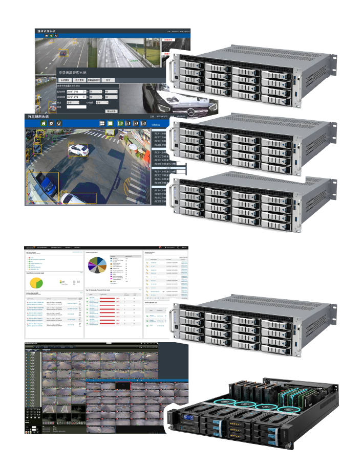
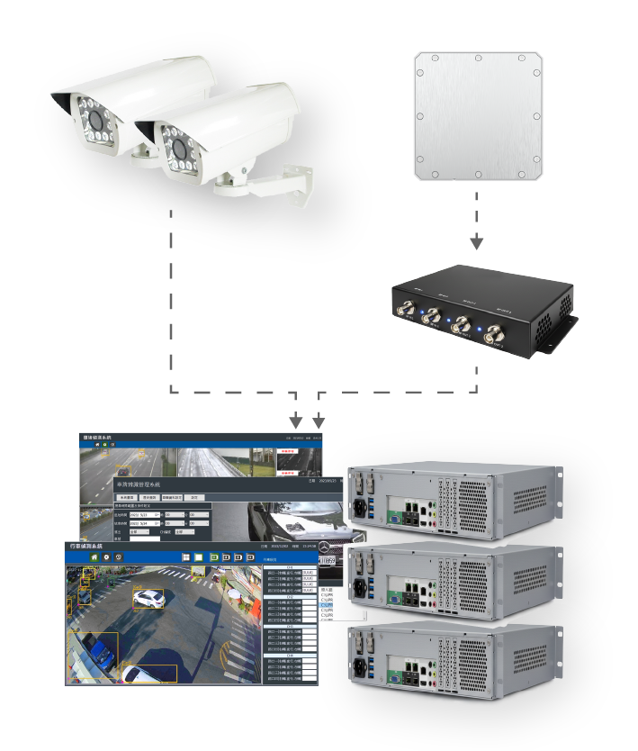
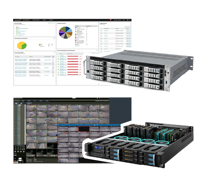
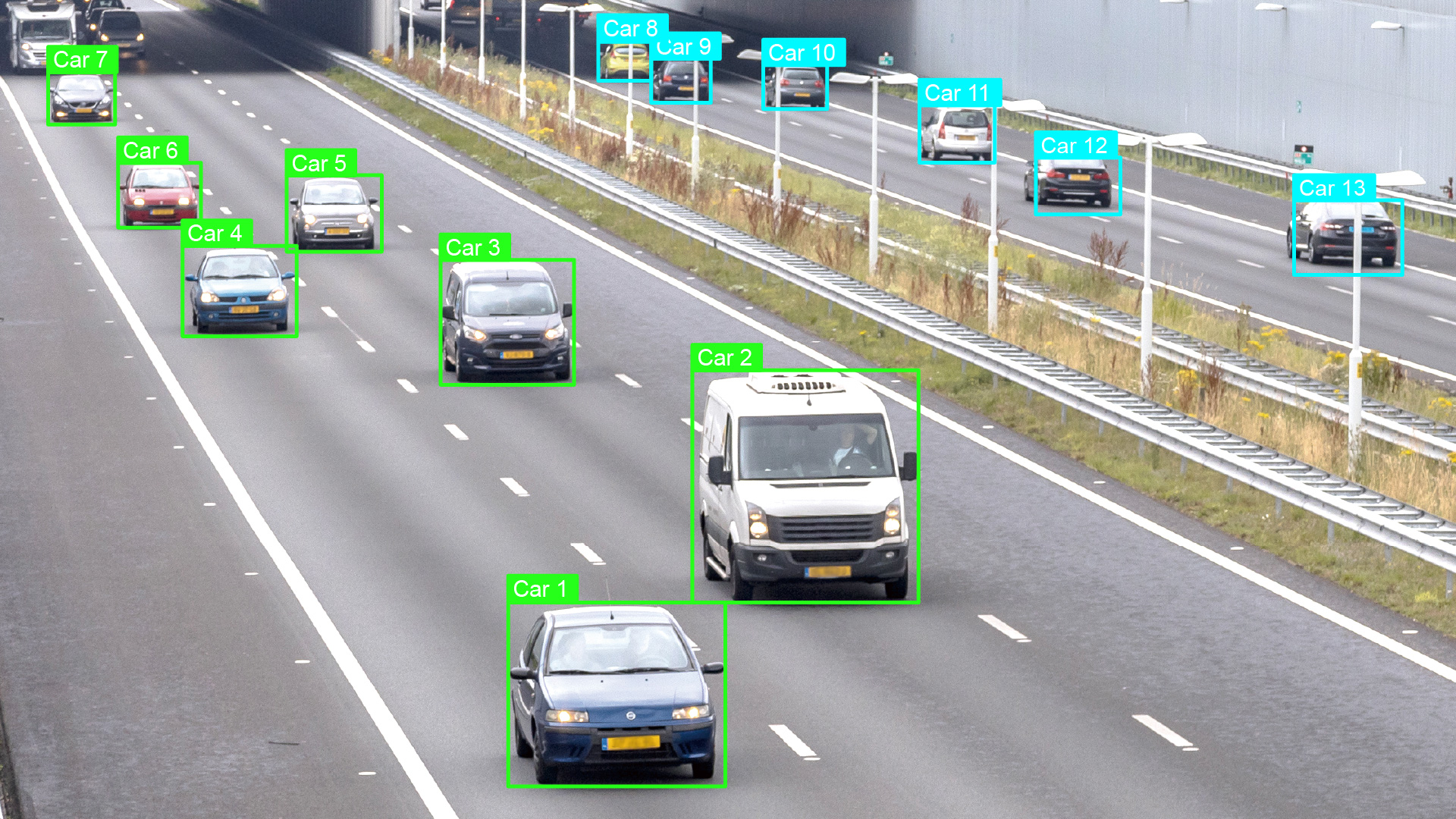
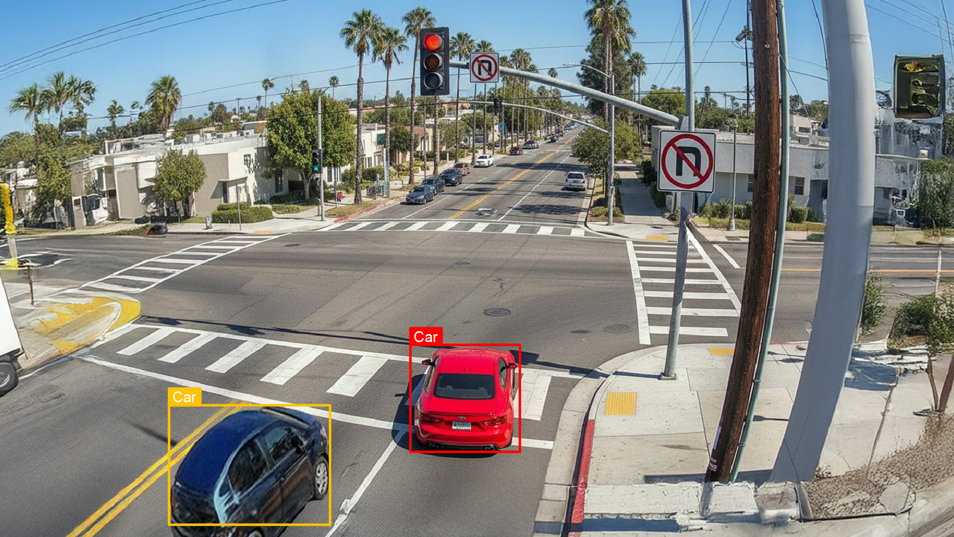
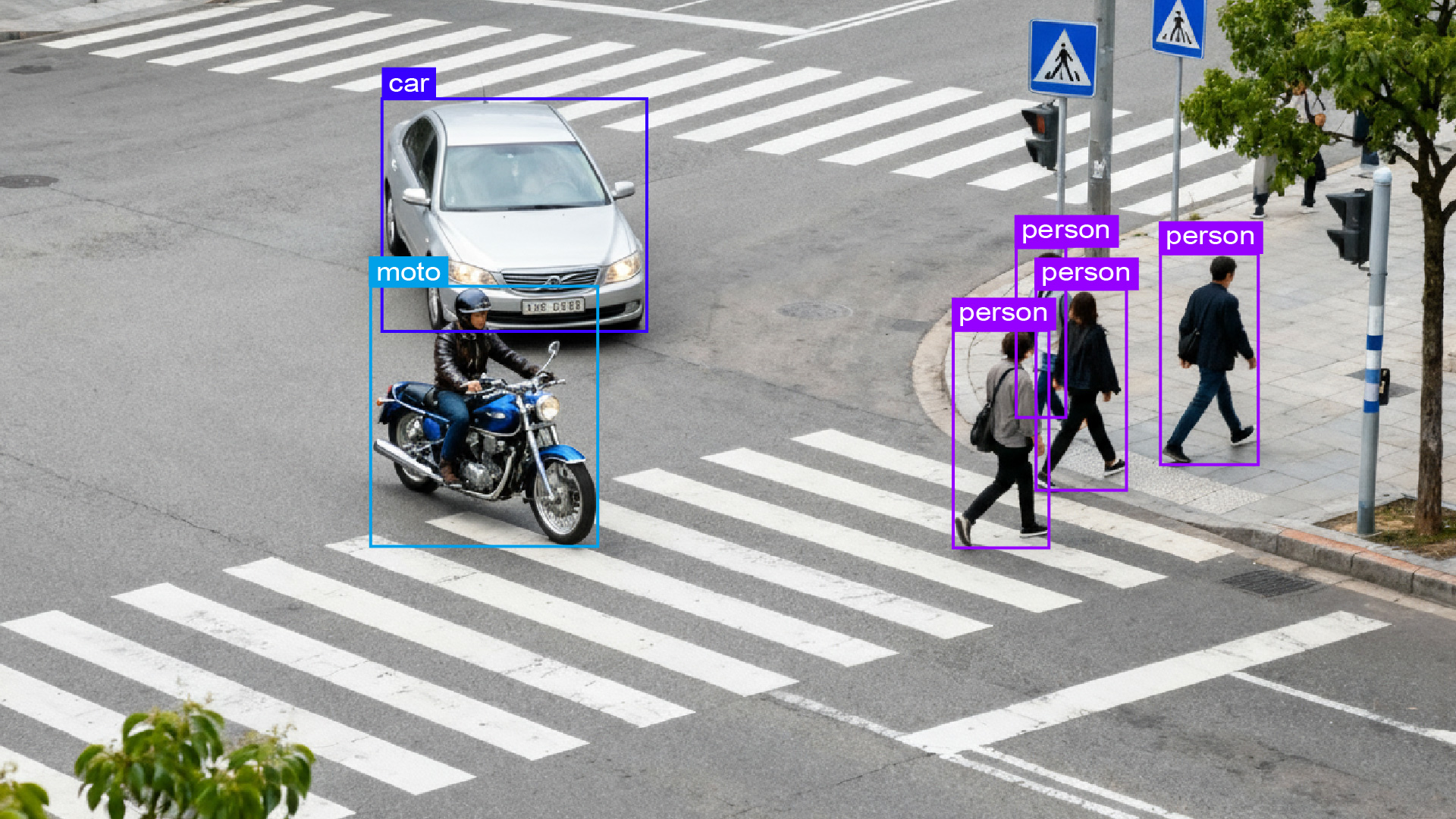
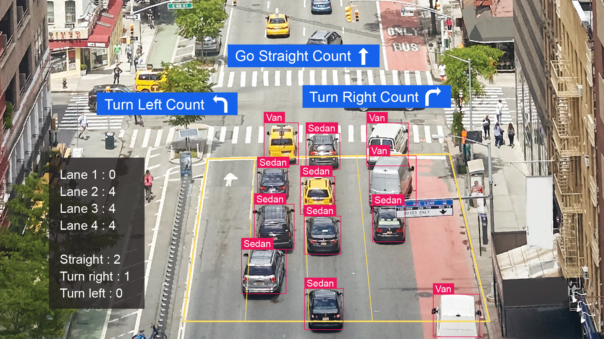
Intelligent Transportation Systems (ITS) are rapidly replacing traditional manual traffic surveys by utilizing automated data collection, vehicle tracking, vehicle classification, and trajectory prediction. These technologies transform massive data sets into real-time actionable insights, supporting transportation planning, traffic control, and safety management. By improving operational efficiency and reducing accident risks, ITS plays a pivotal role in shaping safer and smarter roads.

Globally, ITS development priorities vary by region: Europe focuses on smart signal control and public transport scheduling to achieve sustainability and carbon reduction goals. The United States emphasizes highway management and incident response, strengthening overall road safety. Asian countries such as Singapore, Japan, and South Korea apply ITS to dense urban signal optimization and autonomous vehicle testing. In Taiwan, traffic safety statistics reveal that most accidents occur at intersections. Through big data diagnostics and strategic planning, ITS solutions have been proven effective in improving intersection safety and demonstrating measurable results in smart mobility.

Solution Advantages

Smart Traffic Management Solution
  • AI Traffic Video Analytics

    Developed by Ability Intelligent Corporation (AIC), the proprietary AI algorithm accurately detects vehicles, pedestrians, and traffic incidents — enabling real-time monitoring and data analytics at intersections.

  • Multi-Source Traffic Data Collection

    Supports AVI license plate recognition (including UHF readers), QLD congestion detection, and VDS vehicle turning flow analysis to build a comprehensive traffic monitoring and statistical platform.

  • Real-Time Congestion & Incident Alerts

    Automatically detects traffic congestion, accidents, or anomalies, and instantly reports them to management centers via configurable communication protocols with visualization on digital maps.

  • Flexible Architecture & Multi-Scenario Deployment

    Based on C/S architecture, the system supports multi-station regional management for highways, interchanges, intersections, and urban roads, enabling multi-type event detection and coordinated management.

  • Flexible Architecture & Multi-Scenario Deployment

    Based on C/S architecture, the system supports multi-station regional management for highways, interchanges, intersections, and urban roads, enabling multi-type event detection and coordinated management.

  • Data Management & System Integration

    Provides historical event playback and traffic data queries, supporting customized configuration and third-party platform integration to meet diverse transportation management needs.

Solution Diagram

Centralized Architecture

Field Side

Cameras capture video and send it directly to the data center.

( NET WORK )

Data Center Side

The central server handles AI tasks such as traffic, event, and plate analysis, while the video server manages storage, playback, and retrieval.

( API NET WORK )
Traffic Control Center
Cloud

Distributed / Edge Architecture

Field Side

Using Cameras, RFID, and Controllers to capture imagery and perform real-time plate recognition, traffic analysis, and congestion detection on-site.

( NET WORK )

Data Center Side

The data server consolidates site data, and the video broadcasting server manages all recordings.

( API  NET WORK )
Traffic Control Center
Cloud


Application Fields

Traffic Flow Monitoring

Analyzes live video feeds to detect and track vehicle count, speed, and direction, providing valuable insights into road congestion and traffic flow patterns for transportation authorities.

Violation Detection

Uses AI-based image recognition to identify traffic violations such as illegal stops, lane changes, and red-light running, supporting enforcement agencies with automated monitoring and evidence collection.

Intersection Safety Monitoring

Recognizes vehicles and pedestrians at intersections to ensure signal timing accuracy and detect dangerous or abnormal behaviors, enhancing overall intersection safety.

Regional Road Surveillance

Analyzes vehicle trajectories and flow data to assist urban planners and engineers in road network design, capacity evaluation, signal timing optimization, and traffic simulation studies.